Superfici troppo frammentate
Le particelle utili sono disperse tra proprietari, titoli e condizioni di accesso.
Intelligence territoriale
Legge particelle, vincoli, vocazioni e opportunità pubbliche in una vista operativa per decidere dove intervenire.
Non mancano le mappe
Le particelle utili sono disperse tra proprietari, titoli e condizioni di accesso.
Paesaggio, rischio, uso del suolo e idoneità tecnica vanno verificati prima della proposta.
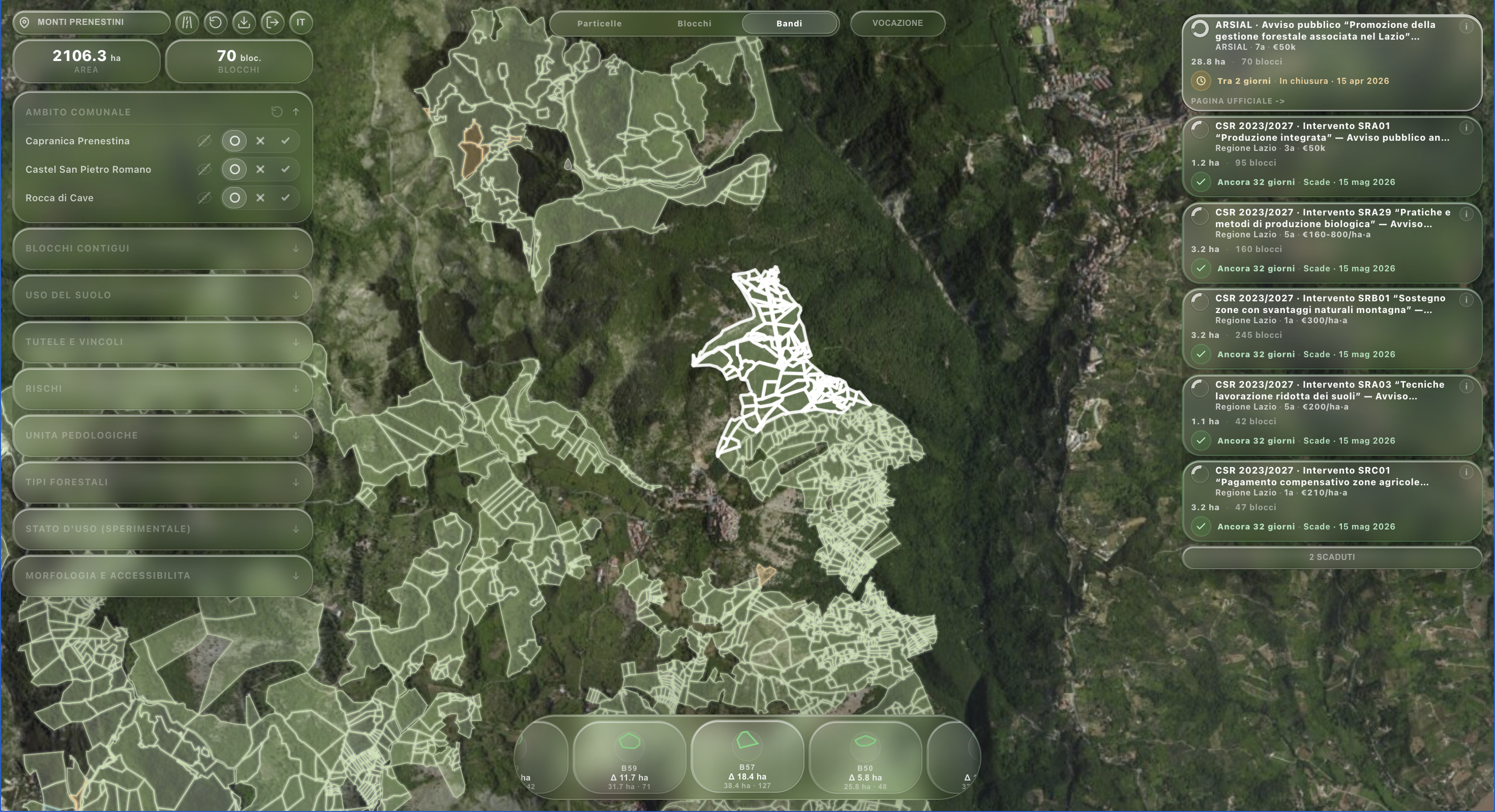
Quando una misura apre, servono già perimetri, requisiti e priorità condivise.
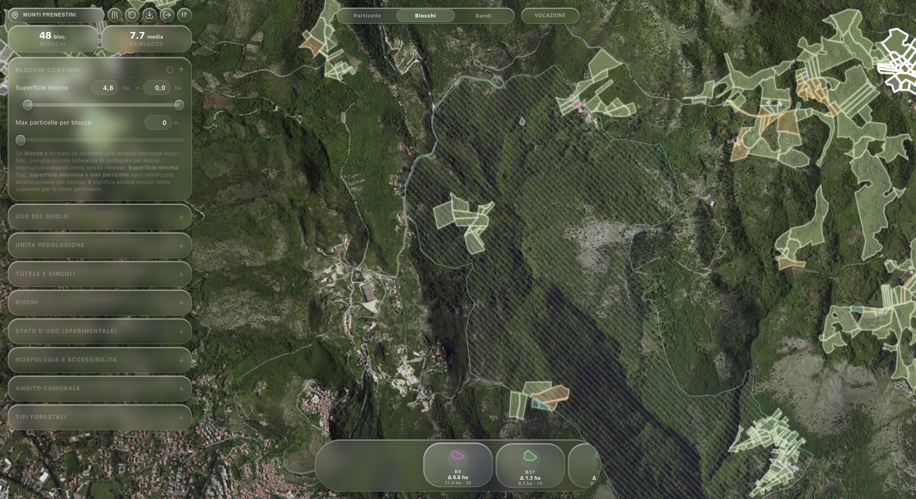
Modello operativo
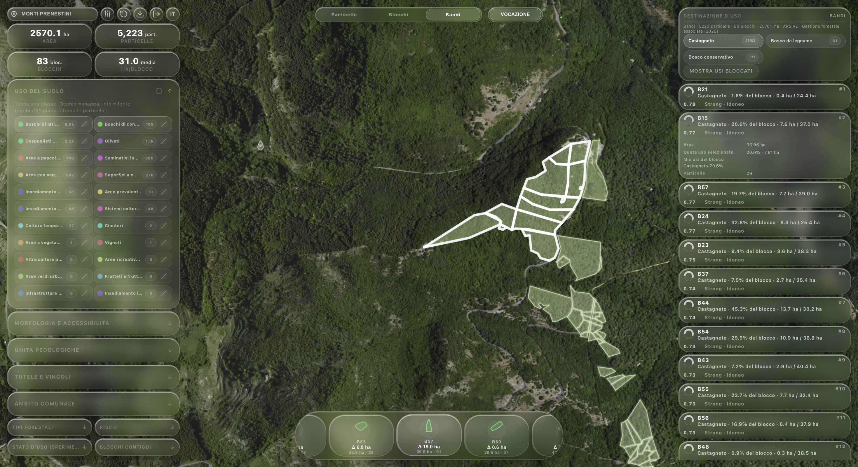
Porta particelle, uso del suolo, accessi e vincoli in una vista interrogabile.
Individua blocchi continui e soglie minime per interventi credibili.
Confronta vocazioni, costi, rischi e compatibilità regolative.
Produce priorità, dossier e materiali per aprire il confronto.
Evidenza verificabile
Attivazione per gradi
Proprietari disponibili, operatori e particelle accessibili per partire.
Massa critica, regole comuni e accesso coordinato agli incentivi.
Dossier, costi e vocazioni per forme cooperative o filiere territoriali.
Demo istituzionale